
Altea Gallery
Featured Maps
Explore our rare antique maps and atlases dating from the 15th to 20th century.

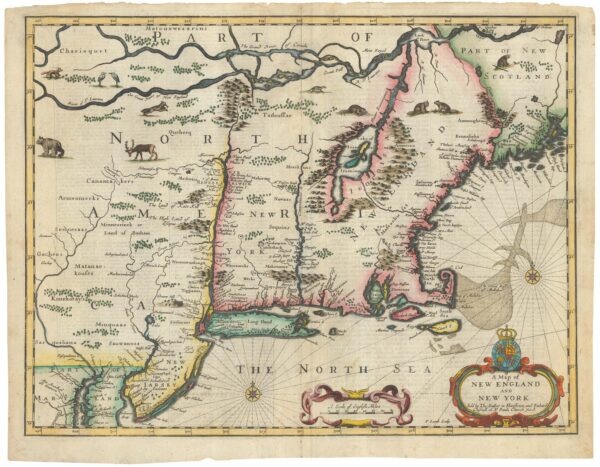
The Speed map of New England


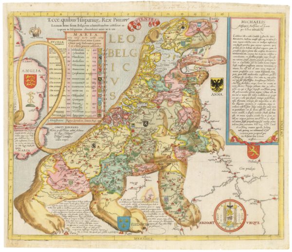
The first 'Leo Belgicus'
New Arrivals
View our latest Antique Maps, Sea Charts, Atlases and Old Globes from the 15th to the 20th century.
-

Ruysch’s 1507 world map, with the earliest obtainable depiction of the Americas
£260,000RUYSCH, Johann.
Published In 1507
Stock No. 22807 -
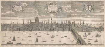
A rare three-sheet prospect of London
£20,000NICHOLLS, Sutton.
Published In 1710
Stock No. 22537 -

Vrients’s scarce map of England, Wales & Ireland
£4,250VRIENTS, Jan Baptist.
Published In 1612
Stock No. 20271 -
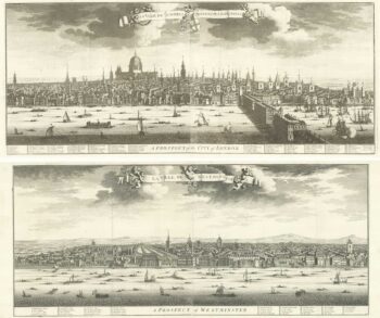
A magnificient pair of early 18th century prospects of London and Westminster
£18,000KIP, Johannes.
Published In 1720
Stock No. 18752 -

A panorama of 17th century London
£7,500HOLLAR, Wenceslaus.
Published In 1879
Stock No. 17907 -
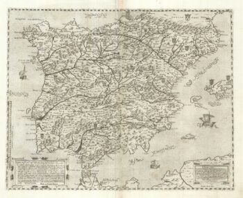
A two-sheet ‘Lafreri-School’ important map of Iberia
£9,750FORLANI, Paolo.
Published In 1567
Stock No. 24477 -
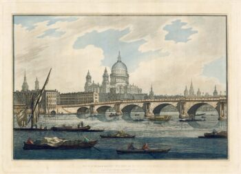
18th century view of the City from the Thames
£1,500FARINGTON, Joseph.
Published In 1790
Stock No. 24557 -

A 17th century chart of the eastern Mediterranean in fine colour.
£1,600DE WIT, Frederick.
Published In 1745
Stock No. 24490
Welcome To Our Shop
In the heart of London’s Mayfair, Altea Gallery have been supplying the best quality Original Rare Maps, Atlases and Globes to collectors, museums, libraries and interior designers around the world since 1992.
Online Catalogues
Browse our wonderful collection of interactive e-Catalogues – download, read and enjoy for free